Tuesday, November 18, 2008
Tuesday, November 11, 2008
Canal Towpath Trail Meeting Recap 11/06/2008
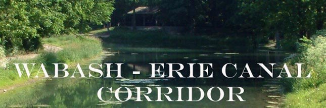
Wabash & Erie Canal Towpath Trail Chapter
Big Four Depot Lafayette, Indiana, 1:30 p.m. History Center
Hosted by Wabash River Enhancement Corporation
RECAP
1. OPENING REMARKS
Several Chapter members had scheduling conflicts and could not be in attendance and we appreciate their providing advanced notice or representative. Meeting was opened with a thank you by Tom Castaldi to the Wabash River Enhancement Corporation for hosting the meeting, providing refreshments and document copying; Lisa Iversen for maintaining our blog site; and Allen County Fort Wayne History Center for copying meeting agendas.
2. MEMBERSHIP
Take time now to write a check for your $15.00 membership dues. A copy of the Banks of the Wabash, "Invitation to Join" can be found on our blog site: wabasheriecanal.blogspot.com. Print out the handy "Membership Categories" section, complete the form, mention "Wabash & Erie Towpath" and place in an envelope with your check and mail to Banks of Wabash, PO Box 1253, Lafayette, Indiana 47902 today. Don’t forget to mark “Wabash & Erie Towpath Chapter in the memo portion of your check that credits us with your membership and goes toward our earning a seat on the board of directors.
3. MARKERS/SIGNS
The "Towpath Trail" signs for directing folks along the Wabash Erie Canal route. We have a series of markers being developed.
1. Wabash River Heritage Corridor “Community” markers are intended for villages, towns and cities along the Wabash River to herald their river-centric history. They are used in addition to the usual city limit signs or club postings on existing posts or kiosks. These are being placed by the communities with the help of the River Commissioners from each county. Ron James has inventory “in stock” for requests.
2. Wabash River Heritage Corridor “Trail” markers are intended for multi-use trail heads and along major roads to mark when crossing Wabash River Heritage Corridor (WRHC) multi-use trails. – Ron James has the artwork and is awaiting ‘demand’ for production.
3. Wabash River Heritage Corridor “River Road” markers are intended for use as an introduction to the Corridor. Intended for use on already existing roads more or less parallel to the river, these can be used at major intersections and route heads. Preferably, the routes chosen will be suitable for biking and ‘Sunday’ driving (i.e. not highways). To the extent we want to get something out to the public, and can parallel the canal towpath, these signs are now available through your WRHC River Commissioners – check the WRHCC website for your county’s contact information.
4. Wabash Erie Canal “Towpath Trail” directional signs are for byway routes in each county along roads that closely follow the historic canal towpath. Quotes have been received for counties to begin ordering. Prices are available in various quantities for the sign which measures 6 inch high by 18 inch wide, blue background, on 0.08 gauge aluminum material, “Engineering Grade” surface, double – sided Wabash & Erie Canal Towpath Trail using the colorful logo. A copy of the new directional sign is available.

50 signs: $17.05 each or total cost of $ 852.50.
75 signs: $14.44 each or total cost of $1,083.00.
100 signs: $13.00 each or total cost of $1,300.00.
Directional Arrows come separately since it will be left to the people mounting the signs to determine which way the arrow should point and how many may be needed. These have been quoted as 4 inch by 4 inch in size and there are 10 arrows in each package. The example given by the vendor, notes that a quantity of 5 packages at $9.50 cost $47.50.
4. TOWPATH TO TRAIL QUESTIONNAIRE.
Committee members: Dawn Ritchie, Stanton Lambert, Dan McCain, Derek Reuter, Dan White. Rory presented a draft design used in the National Park Service’s, Towpaths-to-Trails publication that Rory designed and prepared in 1995. for a comprehensive to assist in exploring the risks and opportunities of creating a trail. Responses from persons responding to the questionnaire will be important for producing a Workbook/Manual as a first step explaining the case for our mission to connect/mark a trail along the Wabash Erie Canal Towpath and Wabash River. It will provide a feel for the concerns of both private and public people/institutions/organizations/businesses to learn where a path might be routed. Rory mentioned that the Ohio Erie Canal Towpath has about three gaps of ten miles each. Some parts are well defined but in heavily populated areas it is virtually impossible to follow the original rout. We want to access where or where not a towpath trail is feasible.
5. QUESTIONNAIRE REVIEW
Bob Schmidt’s sub committee to create a list of contacts to send the questionnaire including WRHC Commissioners, County Historians and selected persons along the corridor familiar with canal and river history are: Carolyn Schmidt, Ron James and Tom Castaldi. It was suggested that in the canal counties not a part of the WRHC should request a representative from the county commissioners.
Once the document has been finalized it should be sent and returns analyzed. Rory will work out the details of where the questionnaires will be returned and suggestions for creating a data base to collect and interpret the responses.
6. TRAIL WORKBOOK/MANUAL
Ride, River and Roam, The Wabash Erie Canal Towpath Trail Inventory and Assessment Manual” Data collected from the survey questionnaire will be used to produce the manual. It will take the cooperation people from each county to complete the information required including: maps, land ownership; connection concerns and standards for trail continuity.
7. NEW BUSINESS
Bernie Dahl requested for a copy of the prototype manual for review. The manual has been prepared to explain the overall plan, risks and opportunities as well as illustrate what by roads most closely follow the Wabash Erie Canal Towpath between Fort Wayne and Terre Haute. He is interested in exploring possibilities of gathering information for his university lab class. Such a project might produce a design manual that would include an inventory of necessary work, design of a typical trail head, and other pertinent factors that may be helpful when taking the project to counties for review.
Rory Robinson suggested that a copy of the Ohio and Erie Guidelines may be available for the Wabash Erie Canal project.
8. MEETING ADJOURNED
Our next meeting will be in the Spring in Wabash, Indiana. A date is being targeted for March.
Tom Castaldi
Wabash Erie Canal Trail Moderator
Monday, October 20, 2008
Next towpath meeting November 6 in Lafayette
Mark your calendar
November 6, 2008
... and plan to be part of the Fall Meeting of the Wabash Erie Canal Towpath Trail Meeting a Banks of the Wabash Chapter.
Meeting Place: Big Four Depot in Lafayette, Indiana
Meeting Time: 1:30 pm
Discussions will include progress with:
1. The "Towpath Trail" signs for directing folks along the the Wabash Erie Canal route...
2. Towpath to Trail Questionnaire design...
3. Progress with list of reviewers for the Workbook
4. Ride, River and Roam, The Wabash Erie Canal Towpath Trail Inventory and Assessment Workbook ...
5. Other business that may come before the group.
Have you sent your $15.00 membership to Banks of the Wabash marked "Wabash & Erie Towpath Chapter" in the memo portion of your check?
Send it today to: Banks of the Wabash, Inc., PO Box 1253, Lafayette IN 47902-1253.
Your membership and participation is helpful to the cause... thanks for taking part!
Click here for directions to the Big 4 Depot:
http://www.eventective.com/USA/Indiana/Lafayette/59708/Big-Four-Depot.html
Monday, July 21, 2008
July 17 Wabash Erie Canal Towpath Meeting Recap
Wabash & Erie Canal Towpath Trail Chapter
Allen County Fort Wayne Historical Society, 1:30 p.m. History Center
Hosted by Allen County Fort Wayne Historical Society, July 17, 2008
RECAP
1. OPENING REMARKS
Attending were: Jim DeVinney, Mark Dickmeyer, Roger Goodland, Dave Hacker, Jennifer Hotchkiss, Stanton Lambert, Dan McCain, Derek Reuter, Dawn Ritchie, Rory Robinson, Ivy Teders, Bob Schmidt, Carolyn Schmidt and Tom Castaldi.
Several of our group who usually meet with us experienced scheduling conflicts and could not be in attendance. Meeting was opened with a thank you by Tom Castaldi to the Allen County History Center for providing a meeting place and to Lisa Iversen who maintains our blog site.
2. MEMBERSHIP
Members were reminded that April is our anniversary month to renew our Banks of the Wabash (BOW) membership. A copy of the "Invitation to Join" can be found on the blogsite: wabasheriecanal.blogspot.com. Print out the handy "Membership Categories" section, complete the form, mention "Wabash & Erie Towpath" and place in an envelope with your check and mail to PO Box 1253 , Lafayette, Indiana 47902 today. Individual membership is $15.00.
3. MARKERS AND DIRECTIONAL SIGNS
Wabash County ’s Mike Beauchamp who could not attend the meeting due to another business commitment but sent a message asking for the status of the Directional Towpath Trail "Canal Boat" silhouette sign, that measures 18 " x 6". Wabash County is ready to mount directional signs. During the meeting, members adopted the new oval Towpath Logo that was designed by the City of Fort Wayne Public Works for use on the Towpath Trail in Allen County . Carroll County expressed an interest in obtaining decals of the oval logo to replace the current “canal boat” design on the Carroll County Towpath Trail. Note: the “Canal Boat Silhouette” term is changed to “Towpath Logo” sign.
Dawn Ritchie agreed to investigate the likelihood of Fort Wayne ’s Public Works supplying a quantity of the oval Towpath Logo signs. (Note: following the meeting, Dawn was asked to learn if Public Works could supply an 18” x 6” sign with the “Towpath” oval logo on the left side and a space for an arrowhead on the right.) Previously, Dawn advised the group that the artwork for the oval logo is available for use on signs, markers, brochures and those places a logo might be used to identify our effort.
Corridor Commissioner Hacker of Huntington County gave a review of the new Wabash River Heritage Corridor River Road markers being distributed by Ron James to Corridor counties. These measure 18" x 24" and introduce the Wabash River Heritage Corridor route and ideal for placing as near the Wabash River as possible. These markers will not necessarily be used on Federal or State highways. A space is provided to accommodate our blue and white 18” x 6” directional Towpath logo signs.
Yet to come is an 18” x 24” WRHC Trail marker intended for trail heads and along major roads to mark where the WRHC Trail crosses. Contact Ron (Email at execdir@wrhcc.in.gov) for details.
Another WRHC Community marker measuring 18” x 24” is designed for entrances of communities who wish to promote their relationship with the WRHC and also is available. Contact Ron for details.
Rory suggested that purchase of signs is an ideal project for raising funds for the project.
Derek asked for a recommendation for spacing between Towpath Logo directional signs. Dan replied that the larger WRHC signs will work well as an entry way with the Towpath Logo. Then a directional sign is needed for each turn right or left and spacing between seems to take care of itself. Long stretches might use a reminder, perhaps as important is obtaining county approval to post the signs. In Carroll County , permission was given to use county road sign posts and worked very well. Dan noted that in Carroll County has developed a “byway” for bikes and cars along appropriate roads, and a walking trail within the Wabash Erie Canal Park system.
4. TRAIL MANUAL
Rory Robinson reviewed the importance of the group producing a Workbook as a first step explaining the case for our mission to connect/mark a trial along the Wabash Erie Canal Towpath and Wabash River . It will provide and inventory of the corridor and what is to be done: 1) preparing a map of the route with urban areas no larger than 3 or 4 blocks while in rural areas increments of 3 to 4 miles should mark both the a Driving Trail and/or a Walking Trail; 2) providing information about land ownership; 3) making certain that the marked trail connects properly with obstacles and with adjoining map routes; 4) determining ownership issues; 5) investigating trail identity concerns; 6) marking accesses; 7) listing user facilities; 8) listing current partners as well as other pertinent action points. Such a manual is vital for grant writing and aiding community officials and the public to better understand the mission. Note: to begin moving the project forward, a ‘corridor,” for a driving/biking route has been written and available on the blog site.
A next step is to draft a questionnaire to be sent to key persons along the corridor. Rory will email a copy of the questionnaire that was used in the National Park Service’s, Towpaths-to-Trails publication that he prepared in 1995. A committee of Dawn Ritchie, Stanton Lambert, Dan McCain, Derek Reuter, Dan White agreed to provide feed-back for Rory’s review to create a final questionnaire for our purposes.
Meanwhile a second sub-committee will work on the names of contacts to send the questionnaire such as WRHC Commissioners, County Historians and selected persons along the corridor familiar with canal and river history. Bob and Carolyn Schmidt will be aided by Ron James and Tom Castaldi in the effort.
5. MEETINGS
Our next meeting will be in the Fall in Lafayette , Indiana . A date is being targeted for November. More information will follow.
2008 National Trails Symposium, Little Rock , Arkansas , November 15-18. Rory Robinson will be taking an active part in this conference. For information go to www.AmericanTrails.org/2008
6. MEETING ADJOURNED
Tom Castaldi
Wabash Erie Canal Trail Moderator
Thursday, June 19, 2008
Next Meeting: Wednesday July 16 in Ft. Wayne
NEXT MEETING - Mark your calendar and plan to be with us on Wednesday, July 16, 2008, in the "Summit City" when we meet in the Allen County Fort Wayne Historical Society's History Center at 1:30 p.m.
The History Center is conveniently located downtown Fort Wayne at 302 East Berry Street. [From the west traveling east, follow U.S. 24 or Jefferson Street into Fort Wayne, and at Lafayette Street turn north and go to the 3rd stop light and turn west on Berry Street. In one half block look for a left turn into the Allen County Fort Wayne Historical Society History Center's parking lot. Traveling from the East heading West, U.S. 24 in Washington Street. Turn north on Lafayette Street and go to the 2nd stop light and turn west on Berry Street. See the History Center in one half block on the left side of Berry Street.]
Our meeting host is the Allen County Fort Wayne Historical Society.
Our Agenda:
1. Opening Remarks
2. Membership: "Banks of the Wabash Chapter" renewal memberships were due in April as our "anniversary" month but it's not too late and your renewal is appreciated. When you do submit your $15.00 individual membership to Banks of the Wabash ( PO Box 1253, Lafayette, Indiana, 47902) don't forget to mark it "Wabash & Erie Towpath."
3: Markers/Signs:
a) Progress Report of "River Road" markers to be used to introduce the Wabash River Heritage Corridor (WRHC) route. These signs are now available through your WRHC Commissioners or for more information contact Ron James.
b) Wabash River Heritage Corridor Trail markers will be forthcoming. These are intended for trail heads and along major roads to mark when crossing the WRHC Trail.
c) Progress of Directional Towpath Trail "Canal Boat" silhouette Banner signs for use to direct trail users through Wabash County are being planned and already in place in Carroll County.
d) View the new "Wabash & Erie Canal Towpath Trail" sign approved and planned for use in Allen County.
4. Trail Manual: Our Situation Analysis draft reveals each step of the driving directions highlighted by bullet points. Each point now may be expanded to become its own page in the Manual. Each page should include: 1) a map prepared for use as both a driving route and or a walking trail of the area in increments of 3 to 4 miles while in distances of only 3 or 4 blocks in urban areas both; 2) background and current information about land ownership; 3) assure that the marked trail connects properly addressing obstacles and meeting adjoining map trails.
5. Adjournment
Thursday, May 15, 2008
Purdue Professor Receives Citizen of the
Bernie Dahl, Program Chair of Landscape Architecture, Purdue University College of Agriculture, and a current director and past president of the Banks of the Wabash, Inc, was the recipient of the 2008 Citizen of the Wabash award presented by the Wabash River Heritage Corridor Commission and one of five national winners honored Sunday evening at the 2008 National River Rally held in Huron, Ohio.
The Wabash River Heritage Corridor Commission’s Citizen award honors those who have provided exemplary service to the Corridor Commission’s vision and mission while River Network’s annual River Hero award celebrates rivers and those who protect them by recognizing some of the victories and honoring those who provide the Network with leadership and inspiration along the way. The award is open to any individual board member, staff, volunteer or private citizen) who has successfully worked with a river conservation organization to improve a river and its watershed and who over the years has made a sustained contribution to the conservation of the river. Click here for a list of past recipients.
Caption: Ron James, left, executive director of the Wabash River Heritage Corridor Commission, presented the 2008 Citizen of the Wabash award and introduced Bernie Dahl, a Banks of the Wabash director, and program chair of Landscape Architecture at
Professor Dahl was already a hero among
Kenneth Einselen, President, Banks of the Wabash, Inc., says of our Hoosier River Hero Award recipient “Bernie Dahl has invested his life and career in the Wabash River . . . [his impact] upon the Wabash River, the lives of his many students, and that [‘spreading influence’ among] many communities today and in the future cannot be measured.”
Dahl's work as program chair for a top 10 landscape architecture school, has broadened his influence to more than 1000 graduates over a period of nearly 35 years. Purdue has allowed him to meld his passion in community assistance and service learning projects. Over the past 20 years Dahl, through this program, has conducted over 150 projects in over 120 communities with the overwhelming number proposing improving watersheds through public enhancement. Many of the communities are targeted because they traditionally would not engage the services of a landscape architect. This enabled Dahl, and the Purdue classes he lead, the opportunity to educate communities of 560 to 130,000 about the benefits of the preservation of the riparian corridor, the maintenance of filters, and the broader mission of the entire corridor.
Monday, May 12, 2008
April 30 Meeting Summary
Wabash & Erie Canal Towpath Trail Chapter
Honeywell Center, 1:30 p.m. Nixon Room
Hosted by Charley Creek Foundation
April 30, 2008
RECAP
1. OPENING REMARKS
Attending were: Michael Beauchamp, Dick Beamer, Joan and Les Keefer, Ron James, Roger Goodland, Bob and Carolyn Schmidt, Dan McCain, Terry Lacy, Dan White and Tom Castaldi. Several of our group who usually meet with us experienced scheduling conflicts and could not be in attendance. Meeting was opened with Tom Castaldi thanking Beth Stein of Charlie Creek Foundation for their support along with her assistance scheduling our meeting and for Lisa Iversen who maintains our blog site. An email letter was read sent by Ray Irvin who is leaving INDOT to work with communities state wide to assist in moving there trail projects to completion. He expressed his willingness to assist us in our efforts going forward.
2. MEMBERSHIP
April is our anniversary month to renew our Banks of the Wabash (BOW) membership. A copy of the "Invitation to Join" can be found on the blogsite. Print out the handy "Membership Categories" section, complete the form, mention "Wabash & Erie Towpath" and place in an envelope with your check and mail to PO Box 1253, Lafayette, Indiana 47902 today. The new membership forms to be supplied by BOW now feature a check off block “Wabash & Erie Towpath.” Individual membership is $15.00.
3. MARKERS AND DIRECTIONAL SIGNS
a) Wabash River Heritage Corridor River Road markers are now available and being distributed by Ron James to Corridor counties. They measure 18" x 24" and introduce the Wabash River Heritage Corridor route. WRHC Commissioners have made these available to trail people interested and may contact Ron James for details. Great for placing as close to the Wabash River as possible, these markers will not necessarily be for use on U.S. or State highways. [A space is provided in the lower portion that will accommodate our blue and white 18” x 6” directional Canal Boat sign.]
The WRHC Trail 18” x 24” markers will be forthcoming. They are intended for trail heads such as the one in Allen County. These will also be utilized at places along major roads to mark where the WRHC Trail crosses. Contact Ron (Email at execdir@wrhcc.in.gov) for details.
The WRHC Community markers are 18” x 24” intended to be used at the entrances of communities who wish to promote their relationship with the WRHC. Contact Ron for details.
b) Directional Towpath Trail "Canal Boat" silhouette sign, 18 " x 6" now be utilized on the Towpath as a directional banner sign in Carroll County and planned for use across Wabash County uses a decal “arrow” to point travel direction. Pre-drilled holes make these easy to attach to the lower portion of the WRHC River Road markers. Dan McCain has agreed to serve as a clearing house to collect requests for these signs. Sign coordinator Brian Stirm will be asked to order the 18” x 6” signs once quantities and costs are determined. Ron James will ask his Commissioners at their upcoming May 14th meeting (to be held in the Old Log Inn, Warrenton, Indiana, in Gibson County) for sign quantities needed per county. The idea is to learn how many the counties wish in the aggregate and then place one large order to receive the lower costs of end-bracket pricing. In those Canal Counties not included in WRHC, the Canal Society of Indiana has agreed to make the availability of directional “Canal Boat” silhouette sign known to its members in those counties not included in WRHC.
c) "Towpath Sign" is patterned after the above signs now being considered by Dawn Ritchie's Towpath Trail group in Allen County. Several designs have been proposed and Roger Goodland noted that no decision had been made according to Dawn Ritchie.
4. TRAIL MANUAL
Report on the progress of a Workbook or Manual recommended by Rory Robinson as a first step explaining the case for our mission to connect/mark a trial along the Wabash Erie Canal Towpath and Wabash River. A Questionnaire draft to be designed by Ron James and a draft of the Situation Analysis by Tom Castaldi was distributed for discussion. Ron James suggested that because each step of driving directions are included in the description separated by bullet points, each point now may be expanded to become its own page in the Manual. The page should include: 1) a map of the area with urban areas no larger than 3 or 4 blocks while in rural areas increments of 3 to 4 miles should mark both the a Driving Trail and/or a Walking Trail; 2) information about land ownership; 3) to make certain that the marked trail connects properly with obstacles and with adjoining map routes.
It was noted that a major benefit of such a manual will serve as a first step to create an identity that people begin to understand that we have something positive going on here.
5. MEETINGS
Mark your calendar for our July 16, 2008. Unless otherwise announced we plan to meet in the History Center, 302 East Berry Street, Fort Wayne. [Follow U.S. 24 or Jefferson Street into Fort Wayne, and at Lafayette Street turn north and go to the 3rd stop light and turn west on Berry Street. In one half block look for a left turn into the Allen County Fort Wayne Historical Society’s History Center’s parking lot. A Fall meeting is tentatively scheduled for November 19, 2008.
6. MEETING ADJOURNED
Monday, April 14, 2008
Next Meeting: April 30 at Honeywell Center
NEXT MEETING - Check your calendar and make sure you have our April 30, 2008, prominently marked!
We'll begin at 1:30 p.m. and meet in the Honeywell Room on the first floor. Make a note that the Honeywell Room is upstairs from the Nixon Room where we have been located. Once again we're being hosted by the Charlie Creek Foundation.
Our Agenda:
1. Opening Remarks
2. Membership: April is our anniversary month to renew our Banks of the Wabash membership. A copy of the "Invitation to Join" can be found on this site. Print out the handy "Membership Categories" section, complete the form, mention "Wabash Erie Canal Towpath Trail" and place in an envelope with your check and mail to PO Box 1253, Lafayette, Indiana 47902 today. 3. Markers/Signs Discussion: For use by interested counties. a) Progress of "River Road," 18" x 24" marker to introduce the Wabash River Heritage Corridor route, which can serve as a master marker program that introduces an approaching "Water Trail, " "Heritage Trail," or "Towpath Trial." Ron James has been obtaining quantity requirements, quotations and production of the "River Road" program. b) Progress of "Canal Boat" silhouette sign, approx. 18 " x 6" Towpath banner used in Carroll County by Dan McCain and proposed for use across Wabash County by Mike Beauchamp. c) Progress of "Towpath Sign" patterned after the above signs now being considered by Dawn Ritchie's Towpath Trail group in Allen County. 4. Trail Workbook/Manual: Report on the progress of a Workbook or Manual recommended by Rory Robinson as a first step explaining the case for our mission to connect/mark a trial along the Wabash Erie Canal Towpath and Wabash River. A Questionnaire draft designed by Ron James and a draft of the Situation Analysis by Tom Castaldi will be discussed for revisions and suggestions going forward. 5. Future Meetings: Discussion. Because our previously planned March 13th meeting was canceled due to a scheduling conflict, the April 30th date was selected. The second meeting was recommended for July 10th in Fort Wayne and a third for November 19th in Delphi. It appears that the July 10th will be moved to Wednesday, July 16th. However, the November 19th is still the tentatively scheduled time. Inputs for meeting dates are welcomed. 6. Adjournment.
Our Agenda:
1. Opening Remarks
2. Membership: April is our anniversary month to renew our Banks of the Wabash membership. A copy of the "Invitation to Join" can be found on this site. Print out the handy "Membership Categories" section, complete the form, mention "Wabash Erie Canal Towpath Trail" and place in an envelope with your check and mail to PO Box 1253, Lafayette, Indiana 47902 today.
Wabash River Heritage Corridor Commission Newsletter: Wabash Reflections
Wabash Reflections
E - news presented by the Wabash River Heritage Corridor Commission (WRHCC).
E - news presented by the Wabash River Heritage Corridor Commission (WRHCC).
With Earth Day & Arbor Day this month, fun on the river cannot be too far behind and the Water Trail starts getting use. Now when you paddle the upper Wabash River the flow is still high enough to make for a good current and avoid portages yet has subsided far enough to allow easy clear passage under bridges (check current conditions before you go). Unfortunately, as the longest unimpeded river east of the Mississippi ends its winter flooding, the pre- ‘leaf out’ banks of the Wabash clearly reflect our societal misdeeds more than at any other time of year. It’s a great time to host a “DeTrash the Wabash” and, accordingly, this issue includes a primer on organizing such an event (the highly successful Tippecanoe County model) as well as the usual reflection of an upcoming river event and a little history to bring perspective. Enjoy!
- A Blueprint for DeTrash the Wabash, Tippecanoe’s is May 17th
- Carroll County’s Heritage Transportation Festival to Open Water Trail June 15th
- Montezuma Once Important Shipping Point
- Notes and Quotes: On tax reporting by non profits and energy saving.
De-Trash the Wabash – Tippecanoe County to host May 17th Event borrowed liberally from the 2007 notes of Rae Schnapp, Wabash Riverkeeper
A river clean-up is one of the most publicly-supported environmental events within the reach of every group of concerned citizens. Such events have the advantage of being easily organized, well supported by businesses, and a quick few hours for volunteers. As there is no reason to re-invent the wheel, often another group is willing to provide some start-up support (The “Banks of the Wabash, Inc.” provides such assistance throughout the Wabash valley) and your group need only touch the local bases for a successful day. Here is a rough primer for how to organize your banks and waterway clean-up.
First, mind your ‘p’s: Proper Prior Planning Prevents Poor Performance. Convene a planning group about 90 days before you want to hold your event. Your meeting’s agenda will include ‘chair’ assignments and selecting a date for your event. Select a date – “American Rivers” provides some free trash bags if your cleanup occurs close to National River Cleanup Week in June (a little late for most of Indiana). Assign a member to each of your major preparation chores: Poke around the cleanup area and note the location of big objects. Pick out and reserve centralized locations for registration as well as the post-event celebration. Place the legal notice in the local paper and apply for your permit from DNR Law Enforcement (if you may have more than 15 watercraft). The exact wording of the legal notice is specified in the application.. Go to http://www.in.gov/dnr/lawenfor/ ‘event permit’.
Your second organizing meeting occurs a little over two months out. Since you’ll want repeat volunteers in the future, and you need to properly dispose of whatever is collected, start obtaining community support. A repeatable event needs donations of finances (through the books of a supportive non-profit), refreshments, prizes and/or a celebration after (to add a spark of fun) and disposal strategies for all types of collected trash. You’ll need “ask” letters to business donors, visits to tire stores so they’ll accept and dispose of tires, and a call to the garbage service for a free dumpster and maybe to arrange bagged trash removal. Don’t forget restaurants, bakeries, groceries, convenience stores and drug stores, any of which may contribute coffee, bagels, donuts, pizza, sandwiches, ice, water, chips or bug spray. Sponsors are usually noted on flyers and, if your finances make it possible, t-shirts for all attendees. Bright T’s work best as color is fun and makes people visible. Consider expected attendees and order more child and lean sizes than the population as a whole. Your local Sheriff and the DNR conservation officer need notice for water safety. Insurance coverage can often be an event rider under a participating non-profit’s normal coverag (check with the Hoosier Environmental Council or your local chapter of the Izaak Walton League). Start a “master” first aid kit as well as small kits for group leaders. Look for donated work gloves and reach extending “grabbers” or spindle sticks.
At 30 days out, create your detailed “action” plan, finalize your budget, assign publicity and volunteer recruitment, and follow-up on donations (sponsors should invite their employees). Prepare posters and get them placed. A handout is good for schools, churches and public events. Get on meeting agendas to inform others of the opportunity. Your regional bottler may give you a free banner. A letter to the editor, covering why, who, what, when, and where, may get printed and, with luck, even a pre-event article (suggest a photo at a needy site or create a photo-op).
Your action plan should include each stretch with a designated team leader and meeting the needs of people, trash, and disposal or recycling. Make last minute community requests to make it all happen. Team packets might include their area map and all phone numbers (central control, other leaders, transportation, emergency, tools (brooms, shovels, wire cutters, winch or horse teams) when needed, etc.). Plan your best event photo and notify your local news outlets. Arrange for your own high resolution photos for newsletters, sponsors, and next year’s publicity.
As your event nears, print out waivers and sign-in sheets, gather clipboards and pens, finalize your team packets and pick-up snacks, water, gloves, and other supplies. To the limit of funds, purchase what wasn’t donated. Get up early on “The Day” and get the coffee, donuts, and ice. Register all attendees by name and contact info and collect waivers. Assign everyone to a team and dispatch, with water, as soon as teams are ready. Ice down drinks and pick-up the post-event food. Take photographs. Have people vie for most unusual trash. Make up fun!
After the event, send out your digital photos and memo on the event to your news outlets. Include all the positive news and quantify the trash. Write a newsletter article for use by participating groups. Return unused purchases. Hold a ‘wrap-up’ meeting for your core help. Note what worked (and what did not), sign thank-you receipts to sponsors, compare your expenses to your budget, and inventory what was left over. Arrange for and store durable items for next year. Settle back and bask in your collective good karma!
For more, go to http://www.hecweb.org/content.cfm?n=wabash or register an event at http://www.americanrivers.org/site/PageServer?pagename=AR7_NationalRiverCleanup
Carrollton Site hosts Heritage Transportation Festival June 14 & 15 by Brian Stirm and Dan McCain, Wabash & Erie Canal Association, Carroll County
The 3rd Annual Heritage Transportation Festival in Carroll County has chosen the new Carrollton bridge for one of its venues in order to highlight our State River, the Wabash, and its role as the first “interstate” in Indiana. What better place and time to hold a ceremony christening the Wabash River Water Trail in Carroll County? A program of the Corridor Commission, the water trail will be officially launched on Sunday afternoon, June 15th among other activities rededicating the bridge northeast of Delphi at the 19th century site of Carrollton.
The Delphi Mainstreet Association is the sponsor of the Festival along with the Wabash & Erie Canal Association and the Delphi Municipal Airport. The two day Festival, June 14th & 15th 2008 highlights the Downtown area of Delphi (around the Courthouse Square) and The Wabash and Erie Canal Park on Saturday with fun activities (plus food & music) for all ages including rides in historic vehicles. Local businesses and vendors will display transportation related items too. On Sunday morning the activity moves to the Airport for a flyin-drivein breakfast, lots of fun flying activities, and Carroll Car Club auto show through the lunch hour. By mid afternoon festival action will move to Carrollton for the Bridge dedication, the Water Trail Grand Opening (canoes & kayaks welcome), and ceremonial recognition of land donations in and around the historic area to the W&E Canal Association. An antique auto hill climb up Carrollton hill may bring the bridge’s function full circle.
Gifts of land near the bridge, to be known as “Grantham’s Landing” on the east, including the canoe launch accepted into the Wabash River Water Trail, and “Mary K’s Overlook” on the west, will serve as interpretive sites pertaining to the Wabash & Erie Canal. The area is historically significant as the only place on the canal where the main line crossed the Wabash River. In their family since the land was offered by the government in the 1830s, before the Wabash & Erie Canal was built, Dick and Polly Grantham, their daughters Susan Grantham and Janet Israel, and Mary K. Grantham-Johnsen’s sons, Curtis and Richard Johnsen of Texas, are deeding the parcels to the Wabash & Erie Canal Association. These two tracts border Towpath Road on the north end of the bridge.
During the canal era this was a bustling area. The planned signage, made possible in part by a generous gift from the Canal Society of Indiana, will explain how horses pulled boats across to re-join the towpath on the other side of the river. Descriptions also will be posted about the Mentzer Tavern, a popular canal stop-over that once stood on the Grantham land, and canal Lock #32 on the Johnsen land. Eventually a trail loop, a picnic area and parking will be available.
Montezuma Once Shipping Point by Penny Cox, Parke County River Commissioner
Talk concerning the possibility of dredging a shipping channel in the Wabash River brought to mind the times when the Wabash was widely used as a means of transportation.
Naturally, the Indians first used the river. The Wabash, Ohio, and Mississippi Rivers were centers of Indian trade and population. This is shown by the extensive mounds built in places of easy access to water transport in many areas of the previously mentioned river valleys by the mound builders. These mound-building Indians had disappeared and been replaced by other Indian tribes by the time Europeans ‘discovered’ this region.
By making use of portages, Indians in the midwest area had good connections between the Great Lakes and the Mississippi Valley.
The two most important portages in Indiana were the Portage from the Little Wabash River to the Maumee River - the site of present day Fort Wayne - thus connecting with Lake Erie, and the portage between the St. Joseph and Kankakee rivers - the site of present day South Bend - connecting with Lake Michigan.
The French explorers, priests, and traders, as well as early British and Colonial travelers, used these same routes. With greater settlement the portages fell into disuse, though the volume of traffic increased on the rivers. Most early shipments were of farm products by flatboat to New Orleans. The trip downstream was relatively simple, but a return trip by boat was difficult because of the current. Steam power solved this problem.
Launched at Pittsburgh in 1811, the "New Orleans" was the first steamboat on interior water systems of the United States. The first Wabash River steamboat was "The Florence" which started operations in the early 1800s, reaching as far north as Terre Haute. The first steamboat to reach the vicinity of Montezuma was "The Ploughboy" which made its way to the mouth of Big Raccoon Creek in 1824. In 1826 during a period of high water, "The American" went up Sugar Creek, passed over the dam at Beard's Mill, and continued as far as the mouth of Rush Creek.
Steamboat travel on the Wabash did not become common until after 1825. Steamboats gave a great boost to travel and resulted in a lowering of freight rates by one-third, but the great bulk of farm products were still carried by flatboat, as is seen by the estimate that over 1000 flatboats entered the Ohio from the Wabash in 1832. Montezuma became one of the early shipping and landing points for early flatboats and steamboats.
Travel by steamboat north of Terre Haute was often difficult because of low water and sandbars. Lafayette was usually the farthest point north that could be reached. Occasionally, Logansport was reached when the water was very high. It was this uncertainty over water levels and obstructions that furnished one of the reasons for the construction of the Wabash-Erie Canal.
More Parke County info is at: http://www.in.gov/mylocal/parke_county.htm or you can get census-type data and a map at http://www.city-data.com/county/Parke_County-IN.html .
Notes & Quotes (from Executive Director Ron James):
As any good river procrastinator will know, just because it is winter is no reason to prepare your taxes. Being as good a river procrastinator as I know, my motto on taxes has always been to hold onto my money as long as possible and “spring” the forms on the government at the last moment. Always some faint hope they’ll be too busy to cash my check. Or at the least, as Learned Hand said: “It is the duty of every citizen to so order their lives as to pay the least amount of taxes possible, indeed, their government demands it of them” or words to that effect. Regardless, with April 15 around the corner, you can all guess what I’m doing this weekend.
But, if you are filing for a small non-profit, your deadline may be still a month off! May 15th of this year is the very earliest possible deadline your small group could face under the Pension Protection Act of 2006. Under that Act, most small tax-exempt organizations, whose gross receipts are normally $25,000 or less, must file Form 990-N, Electronic Notice (e-Postcard) for Tax-Exempt Organizations not Required To File Form 990 or 990-EZ. Before this law was enacted, these small organizations were not required to file annually with the IRS. The e-Postcard is due every year by the 15th day of the fifth month after the close of your tax year (usually the same as your accounting period) starting with tax years ending on or after December 31, 2007. For example, if your tax year ended on December 31, 2007, the e-Postcard is due May 15, 2008. For more: http://www.irs.gov/charities/article/0,,id=177783,00.html
If only it were so easy to work with the environment. With our long winter, my usual visits to the river have been thwarted by an unusually lengthy period of flood. Our water trail access signs have been more of a hint of an eddy than usable markers for river users. But I have enjoyed trying to get to the river in between environmental events. Speaking of which, did you turn off your lights for “Earth Hour” last weekend? While getting ready for that event, or non event as the case may be, I ran across some computer energy tips that could help the earth as well as cash on hand. With this being a computer newsletter, I’ll share a few:
* Set up your computer’s power options such that your PC goes into standby mode after 15 minutes of non use and into hibernation or sleep after 45 minutes of non use. These energy saving modes cut your PC's electric usage down to just a few watts.
* Turn off your monitor when it is not in use. The monitor consumes over half of the energy used by a computer. Screen savers, while effective in preserving the monitor, use the same amount of energy as when you are using the computer.
* Print only the pages you need. Printing can be the most energy-intensive step. Edit documents on-screen and use print preview to reduce the number of drafts printed. Leave your printer off the rest of the time.
* Buy a laptop as your next PC. Laptops use 10 percent or less of the electricity consumed by typical desktop computers.
And, certainly, when you can, shut the whole thing down and…See you on the river!
- Ron
Sunday, April 6, 2008
April 30: Banks of Wabash Meeting
__________________________________________________________
NEXT MEETING - Check your calendar and make sure you have our April 30, 2008, prominently marked!
We'll begin at 1:30 p.m. and meet in the Honeywell Room on the first floor. Make a note that the Honeywell Room is upstairs from the Nixon Room where we have been located. Once again we're being hosted by the Charlie Creek Foundation.
A G E N D A
1. Opening Remarks
2. Membership: April is our anniversary month to renew our Banks of the Wabash membership. A copy of the "Invitation to Join" can be found on this site. Print out the handy "Membership Categories" section, complete the form, mention "Wabash Erie Canal Towpath Trail" and place in an envelope with your check and mail to PO Box 1253, Lafayette, Indiana 47902 today.
3. Markers/Signs Discussion: For use by interested counties.
- Progress of "River Road," 18" x 24" marker to introduce the Wabash River Heritage Corridor route, which can serve as a master marker program that introduces an approaching "Water Trail, " "Heritage Trail," or "Towpath Trial." Ron James has been obtaining quantity requirements, quotations and production of the "River Road" program.
- Progress of "Canal Boat" silhouette sign, approx. 18 " x 6" Towpath banner used in Carroll County by Dan McCain and proposed for use across Wabash County by Mike Beauchamp.
- Progress of "Towpath Sign" patterned after the above signs now being considered by Dawn Ritchie's Towpath Trail group in Allen County.
4. Trail Workbook/Manual:
Report on the progress of a Workbook or Manual recommended by Rory Robinson as a first step explaining the case for our mission to connect/mark a trial along the Wabash Erie Canal Towpath and Wabash River. A Questionnaire draft designed by Ron James and a draft of the Situation Analysis by Tom Castaldi will be discussed for revisions and suggestions going forward.
5. Future Meetings:
Discussion. Because our previously planned March 13th meeting was canceled due to a scheduling conflict, the April 30th date was selected. The second meeting was recommended for July 10th in Fort Wayne and a third for November 19th in Delphi. It appears that the July 10th will be moved to Wednesday, July 16th. However, the November 19th is still the tentatively scheduled time. Inputs for meeting dates are welcomed.
6. Adjourn
Saturday, February 23, 2008
The Artist as Historian: Painting the Wabash and Erie Canal
"The Artist as Historian: Painting the Wabash and Erie Canal" is the lecture topic by artist Terry Lacy, to be presented on Sunday, April 6, 2008, at the Allen County Fort Wayne Historical Society's George R. Mather Lecture Series.
The one hour long, 2:00 p.m. event that takes place in the Freimann Room at 302 East Berry Street, Fort Wayne, Indiana, is free to the public.
The one hour long, 2:00 p.m. event that takes place in the Freimann Room at 302 East Berry Street, Fort Wayne, Indiana, is free to the public.
How far does "artistic license" go? There have been many illustrations over the years romanticizing epic moments in history. Many of these have been flights of fancy with little connection to real facts. That cannot be said of works created by Terry Lacy, an artist with a conscience.
In creating a mural composed of a series of large scale oil paintings for the Wabash & Erie Canal Interpretative Center in Delphi, Indiana, in Carroll County, Lacy who has degrees from Herron School of Art (BFA) and Indiana University (MFA), had to imagine what certain sites may have looked like long after they had been altered by the intrusion of a modern world. Through extensive research and a keen eye for telling details, he created a sense of time and space from a bygone era. The mural circles the entire lobby of the Interpretive Center and most of the paintings measure between six and eleven feet in length.
Murals depict scenes on the Wabash & Erie Canal extending from Toledo, Ohio, through Fort Wayne, Wabash, Logansport, Delphi, Lafayette, Attica, Terre Haute south to Evansville on the Ohio River. This highly visual presentation will demonstrate how historic clues can contribute to a more faithful artistic expression.
Thursday, February 14, 2008
Wabash Erie Canal Towpath Trail Meeting - April 30, 2008
Don't miss being a part
of helping connect your community's trail
as we form the
Wabash Erie Canal Towpath Trail!
of helping connect your community's trail
as we form the
Wabash Erie Canal Towpath Trail!

Meeting Location: Wabash, Indiana, at the Honeywell Center corner of West Market and South Carroll streets...a mere 115 yards from the historic towpath.
Place: "Honeywell Room" on the 1st floor of the Honeywell Center, at
Date: April 30, 2008.
Time: 1:30 p.m.
Agenda: 1) Markers. 2) Wabash Erie Canal Towpath Trail Workbook.
Hosted by: Charlie Creek Foundation.
Subscribe to:
Posts (Atom)


